
[论文解读] Mapping Walnut Water Stress with High Resolution Multispectral UAV Imagery and Machine Learning
本研究开发了一套机器学习框架,利用高分辨率多光谱无人机影像和气象数据,在单株水平上对核桃树水分胁迫进行制图。通过应用随机森林回归与分类模型,其在估计茎水分势和分类胁迫水平方面分别实现了 R² = 0.70 和 85% 的准确率,证明了该方法在加州核桃园精准灌溉中是一种可扩展、低成本的替代人工测量方案。
Effective monitoring of walnut water status and stress level across the whole orchard is an essential step towards precision irrigation management of walnuts, a significant crop in California. This study presents a machine learning approach using Random Forest (RF) models to map stem water potential (SWP) by integrating high-resolution multispectral remote sensing imagery from Unmanned Aerial Vehicle (UAV) flights with weather data. From 2017 to 2018, five flights of an UAV equipped with a seven-band multispectral camera were conducted over a commercial walnut orchard, paired with concurrent ground measurements of sampled walnut plants. The RF regression model, utilizing vegetation indices derived from orthomosaiced UAV imagery and weather data, effectively estimated ground-measured SWPs, achieving an $R^2$ of 0.63 and a mean absolute error (MAE) of 0.80 bars. The integration of weather data was particularly crucial for consolidating data across various flight dates. Significant variables for SWP estimation included wind speed and vegetation indices such as NDVI, NDRE, and PSRI.A reduced RF model excluding red-edge indices of NDRE and PSRI, demonstrated slightly reduced accuracy ($R^2$ = 0.54). Additionally, the RF classification model predicted water stress levels in walnut trees with 85% accuracy, surpassing the 80% accuracy of the reduced classification model. The results affirm the efficacy of UAV-based multispectral imaging combined with machine learning, incorporating thermal data, NDVI, red-edge indices, and weather data, in walnut water stress estimation and assessment. This methodology offers a scalable, cost-effective tool for data-driven precision irrigation management at an individual plant level in walnut orchards.
研究动机与目标
- 开发一种可扩展的非侵入性方法,用于在整个果园范围内监测核桃树水分胁迫,以支持精准灌溉。
- 通过利用高分辨率无人机遥感技术,克服人工密集型、点状测量的茎水分势(SWP)方法的局限性。
- 将多光谱影像、热力数据和气象变量(风速、温度、水汽压 deficit)整合到机器学习模型中,以提升 SWP 估计精度。
- 评估植被指数(NDVI、NDRE、PSRI)和气象因子在预测核桃树水分胁迫中的相对重要性。
- 以高准确率将水分胁迫分类为三个严重程度等级(轻度、中度、重度),以支持可操作的灌溉规划。
提出的方法
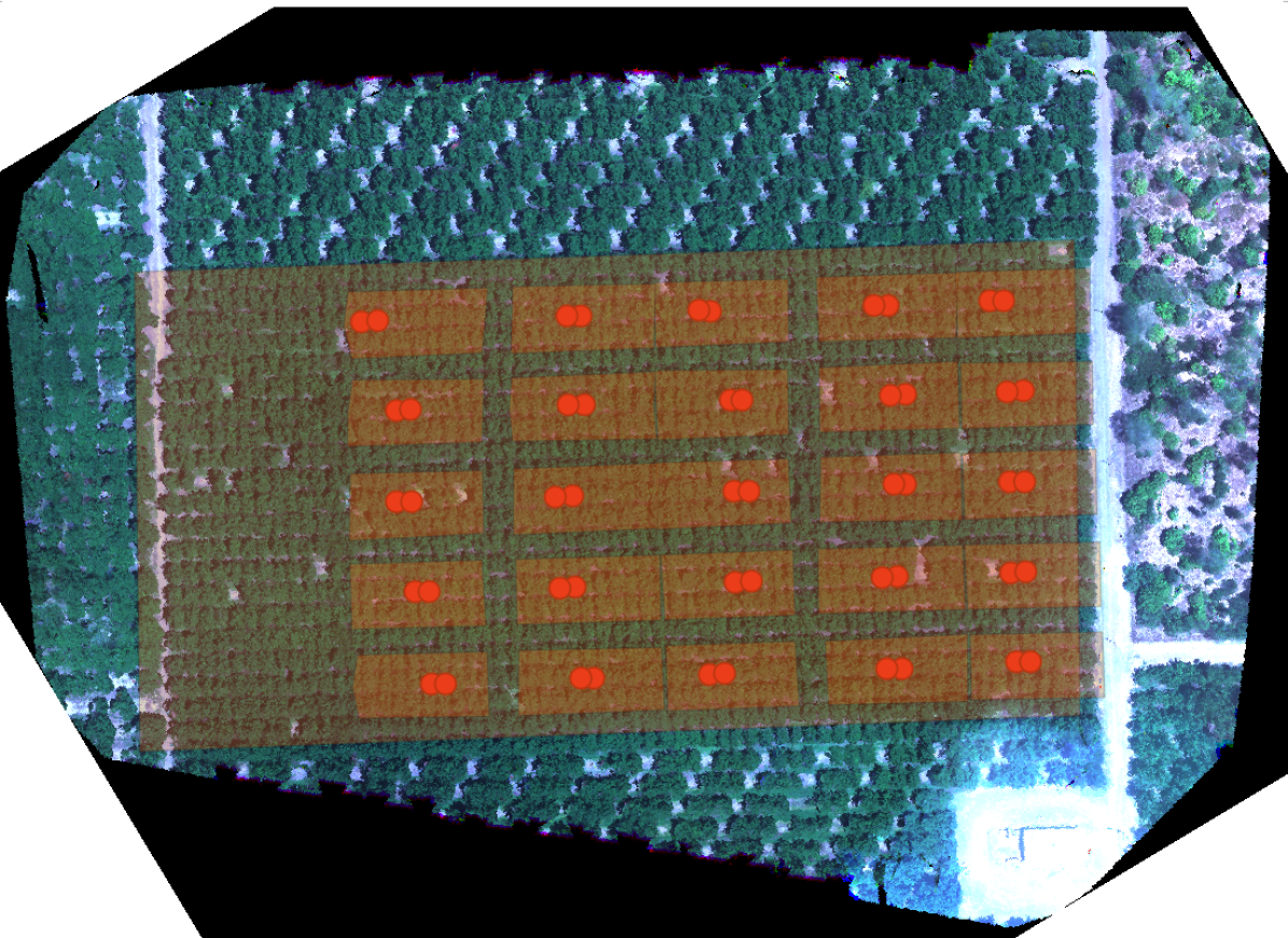
- 在商业核桃园上进行了五次无人机飞行,使用七波段多光谱相机获取高分辨率正射镶嵌影像。
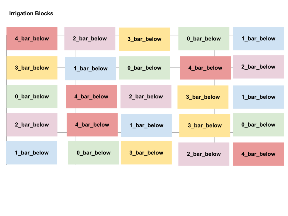
- 通过压力室法从 200 株核桃树中同步采集地面实测 SWP 数据,用于模型校准。
- 计算了关键植被指数,包括 NDVI、NDRE、PSRI,并利用多光谱传感器的热力波段数据。
- 整合了附近气象站提供的本地气象数据(风速、空气温度、水汽压 deficit),以考虑时间变化的影响。
- 使用整合数据集训练随机森林回归与分类模型,并通过特征重要性分析识别关键预测因子。
- 应用归一化过量绿色指数(NExG)以过滤热力与多光谱影像中的阴影影响。
实验结果
研究问题
- RQ1高分辨率多光谱无人机影像结合气象数据是否能够在大范围内实现对核桃树茎水分势(SWP)的精确估计?
- RQ2哪些植被指数(NDVI、NDRE、PSRI 等)和气象变量(风速、VPD、温度)对预测核桃树水分胁迫最具预测力?
- RQ3与仅使用标准指数的模型相比,引入红边指数(NDRE、PSRI)在 SWP 估计精度方面有何提升?
- RQ4机器学习分类模型是否能可靠地将核桃树水分胁迫划分为三个明确等级(轻度、中度、重度)?
- RQ5在不同飞行日期、条件多变的情况下,整合气象数据在多大程度上提升了模型性能?
主要发现
- 随机森林回归模型在估计地面实测茎水分势(SWP)时,R² 达到 0.70,平均绝对误差(MAE)为 0.80 巴。
- 整合气象数据,特别是风速,显著提高了模型在不同飞行日期的一致性,凸显其在时间数据整合中的重要性。
- NDVI 是 SWP 估计中最重要的植被指数,其次是热力波段、NDRE 和 PSRI,按重要性依次递减。
- 若排除红边指数(NDRE、PSRI),模型准确率下降,R² 降至 0.63,证实其在捕捉早期水分胁迫中的价值。
- 随机森林分类模型以 85% 的准确率正确预测了水分胁迫严重程度等级,优于简化模型(准确率 80%)。
- 本研究证实,通过机器学习整合多光谱、热力和气象数据,可实现对核桃园中单株水平水分胁迫的精确、可扩展且低成本的制图。
更好的研究,从现在开始
从阅读论文到最终审阅,大幅缩短您的研究时间。
无需绑定信用卡
本解读由 AI 生成,并经人工编辑审核。