
[论文解读] Metropolitan Scale and Longitudinal Dataset of Anonymized Human Mobility Trajectories
本论文介绍了一个开源、匿名化、城市尺度且具有纵向特性的大规模人类轨迹数据集,涵盖在日本某未指明的都市区域中,10万名个体在90天内通过手机定位信号收集的轨迹数据。该数据集将空间划分为500米×500米的网格单元,时间划分为30分钟的时间段,包含75天的正常行为和15天的紧急状况,支持通过HuMob Challenge 2023对移动预测模型进行公平基准测试。
Modeling and predicting human mobility trajectories in urban areas is an essential task for various applications. The recent availability of large-scale human movement data collected from mobile devices have enabled the development of complex human mobility prediction models. However, human mobility prediction methods are often trained and tested on different datasets, due to the lack of open-source large-scale human mobility datasets amid privacy concerns, posing a challenge towards conducting fair performance comparisons between methods. To this end, we created an open-source, anonymized, metropolitan scale, and longitudinal (90 days) dataset of 100,000 individuals' human mobility trajectories, using mobile phone location data. The location pings are spatially and temporally discretized, and the metropolitan area is undisclosed to protect users' privacy. The 90-day period is composed of 75 days of business-as-usual and 15 days during an emergency. To promote the use of the dataset, we will host a human mobility prediction data challenge (`HuMob Challenge 2023') using the human mobility dataset, which will be held in conjunction with ACM SIGSPATIAL 2023.
研究动机与目标
- 为解决当前缺乏开源、大规模且保护隐私的人类移动数据集,以实现移动预测模型性能的公平比较。
- 提供一个具有纵向特征的城市尺度数据集,包含通过移动设备在90天内收集的真实轨迹,涵盖正常与紧急状况。
- 通过与ACM SIGSPATIAL 2023合作举办数据挑战赛(HuMob Challenge 2023),实现可复现的研究与基准测试。
- 通过高保真、匿名化的移动数据,支持城市规划、流行病建模和灾害风险管理。
提出的方法
- 从约5%的Yahoo Japan应用用户中收集匿名化的手机定位信号,移除用户ID及个人属性(如性别、年龄)等信息。
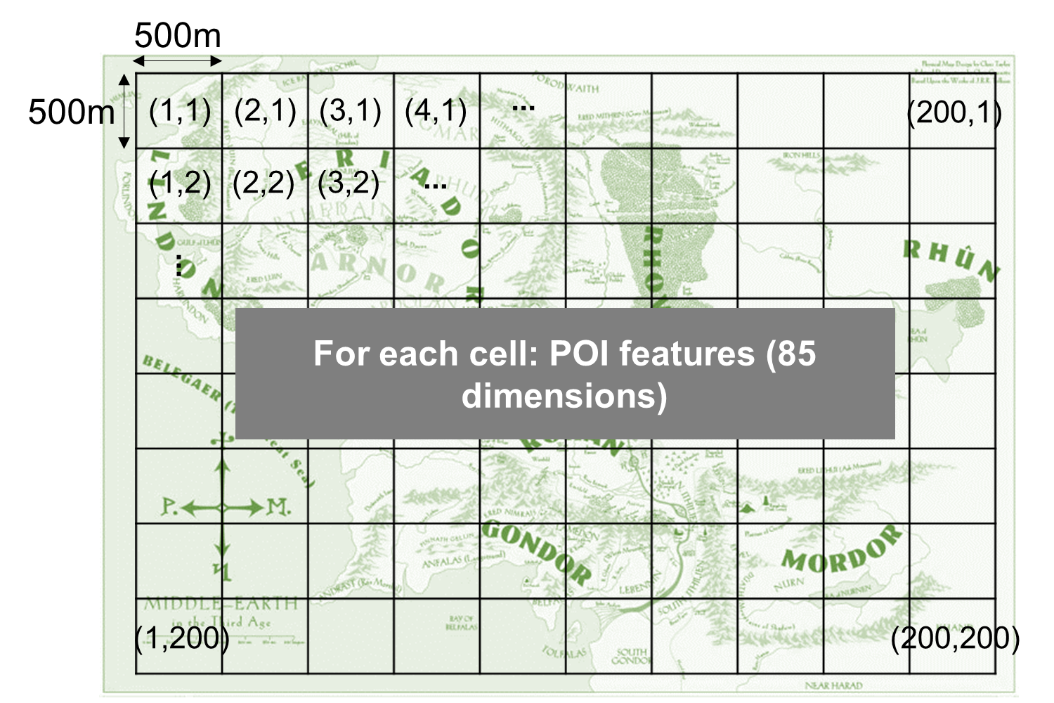
- 将位置数据在空间上离散化为500米×500米的网格单元,在时间上按30分钟间隔分箱,以保护隐私。
- 90天的数据集包含75天的常规行为和15天的紧急状况,其移动模式发生改变。
- 提供一个独立的POI数据集,每个网格单元包含85维向量,表示不同兴趣点类别的数量,但不透露名称。
- 通过Zenodo(DOI: 10.5281/zenodo.8111993)发布数据集,并用于举办HuMob Challenge 2023,以进行移动轨迹预测。
- 评估采用动态时间规整(DTW)和GEO-BLEU指标,以衡量轨迹相似性和局部特征准确性。
实验结果
研究问题
- RQ1如何在保护个人隐私的前提下,负责任地收集和共享大规模、匿名化且具有纵向特征的人类移动数据?
- RQ2在真实世界数据支持下,机器学习模型在城市环境中对掩码轨迹的预测能力在多大程度上可实现?
- RQ3紧急状况在多大程度上影响人类移动模式?模型能否在正常与异常行为阶段之间实现泛化?
- RQ4辅助POI数据对移动轨迹预测模型的准确性有何影响?
- RQ5开源、标准化的数据集是否能够实现不同研究团队之间人类移动预测方法的公平且可复现的基准测试?
主要发现
- 该数据集包含10万名匿名个体在90天内的移动轨迹,其中75天为正常行为,15天为紧急状况。
- 数据集在空间上被离散化为500米×500米的网格单元,在时间上按30分钟分箱,确保用户隐私。
- HuMob Challenge 2023成功举办,共邀请10支顶尖团队在汉堡举行的ACM SIGSPATIAL 2023上进行展示。
- 挑战赛包含两项预测任务:一项针对20,000名被掩码的个体(任务1),另一项针对2,500名被掩码的个体(任务2),均需完成轨迹重建。
- 评估指标包括动态时间规整(DTW)和GEO-BLEU,GEO-BLEU的公开代码可在 https://github.com/yahoojapan/geobleu 获取。
- 该数据集可在 https://zenodo.org/record/8111993 公开获取,支持城市移动建模领域的可复现研究。

更好的研究,从现在开始
从阅读论文到最终审阅,大幅缩短您的研究时间。
无需绑定信用卡
本解读由 AI 生成,并经人工编辑审核。