
[论文解读] A scalable system to measure contrail formation on a per-flight basis
本文提出了一套可扩展的自动化系统,用于从GOES-16卫星红外影像中检测并匹配持久性航迹凝结尾迹,实现对160万架次航班的逐架次凝结尾迹形成评估。主要贡献在于建立了一个大规模经验基准,表明当前基于天气的凝结尾迹预测模型中的缺陷使凝结尾迹规避策略的成本增加约一个数量级,尽管其整体仍具成本效益。
Persistent contrails make up a large fraction of aviation's contribution to global warming. We describe a scalable, automated detection and matching (ADM) system to determine from satellite data whether a flight has made a persistent contrail. The ADM system compares flight segments to contrails detected by a computer vision algorithm running on images from the GOES-16 Advanced Baseline Imager. We develop a 'flight matching' algorithm and use it to label each flight segment as a 'match' or 'non-match'. We perform this analysis on 1.6 million flight segments. The result is an analysis of which flights make persistent contrails several orders of magnitude larger than any previous work. We assess the agreement between our labels and available prediction models based on weather forecasts. Shifting air traffic to avoid regions of contrail formation has been proposed as a possible mitigation with the potential for very low cost/ton-CO2e. Our findings suggest that imperfections in these prediction models increase this cost/ton by about an order of magnitude. Contrail avoidance is a cost-effective climate change mitigation even with this factor taken into account, but our results quantify the need for more accurate contrail prediction methods and establish a benchmark for future development.
研究动机与目标
- 开发一种可扩展的自动化方法,利用卫星和航班数据确定单个航班是否形成持久性凝结尾迹。
- 通过将观测到的凝结尾迹与模型预测进行比较,建立大规模经验基准以评估凝结尾迹预测模型。
- 量化天气预报数据中的不准确性(尤其是相对湿度)对凝结尾迹规避策略成本效益的影响。
- 使用真实世界观测数据而非模拟输入数据,评估现有凝结尾迹预测模型的性能。
- 为改进凝结尾迹预测和验证未来缓解策略提供基础。
提出的方法
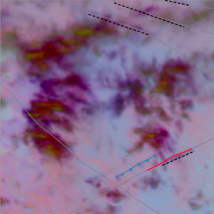
- 利用在GOES-16先进基线成像仪(ABI)红外影像上训练的计算机视觉模型,检测持久性凝结尾迹。
- 应用航班匹配算法,基于空间和时间上的接近度将检测到的凝结尾迹与航班段关联,阈值经优化以确保准确性。
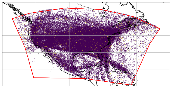
- 处理了连续美国地区168小时的卫星数据中的160万架次航班段。
- 使用天气预报和再分析数据,将观测到的凝结尾迹匹配结果与多个凝结尾迹形成模型的预测结果进行比较。
- 采用精确率和召回率指标,基于经验真实值评估模型性能。
- 利用包含160万架次航班段和12,000个检测到的凝结尾迹的数据集,为未来模型开发建立基准。
实验结果
研究问题
- RQ1在美国本土地区,有多少比例的航班会产生持久性凝结尾迹?该比例如何随一天中的时间、季节和航班密度而变化?
- RQ2当与真实卫星观测结果进行验证时,当前基于天气的模型在预测凝结尾迹形成方面的准确性如何?
- RQ3高层大气湿度预报中的误差在多大程度上会降低凝结尾迹预测模型的性能?
- RQ4预测模型的不完善性在多大程度上影响了通过空中交通改航以避免凝结尾迹形成的成本效益?
- RQ5是否可以构建一个可扩展的自动化系统,在大规模范围内可靠地将卫星检测到的凝结尾迹与单个航班段关联?
主要发现
- 该系统成功识别了160万架次航班段的凝结尾迹形成情况,数据量比以往任何研究高出一个数量级。
- 约10%的航班产生了持久性凝结尾迹,且白天和高密度空域区域的产生率更高。
- 基于天气预报数据的凝结尾迹预测模型表现出显著的性能差距,其精确率和召回率因输入数据源不同而差异显著。
- 高层大气相对湿度预报中的不完善性被发现使每吨CO2当量避免成本增加约一个数量级。
- 尽管如此,凝结尾迹规避策略仍具极高的成本效益,即使存在模型误差,其效益估计仍为成本的1,000倍。
- 本研究建立了新的基准数据集和方法论,用于评估和改进未来的凝结尾迹预测模型。
更好的研究,从现在开始
从阅读论文到最终审阅,大幅缩短您的研究时间。
无需绑定信用卡
本解读由 AI 生成,并经人工编辑审核。