
[논문 리뷰] Deep Learning for Slum Mapping in Remote Sensing Images: A Meta-analysis and Review
이 논문은 원격 탐지 데이터로부터 슬럼 맵핑에 대한 심층 학습 접근법에 대한 체계적 메타 분석(2014–2024)을 수행하여 아키텍처, 데이터 소스, 전처리 및 도전에 대해 요약하고 향후 연구를 안내합니다.
The major Sustainable Development Goals (SDG) 2030, set by the United Nations Development Program (UNDP), include sustainable cities and communities, no poverty, and reduced inequalities. However, millions of people live in slums or informal settlements with poor living conditions in many major cities around the world, especially in less developed countries. To emancipate these settlements and their inhabitants through government intervention, accurate data about slum location and extent is required. While ground survey data is the most reliable, such surveys are costly and time-consuming. An alternative is remotely sensed data obtained from very high-resolution (VHR) imagery. With the advancement of new technology, remote sensing based mapping of slums has emerged as a prominent research area. The parallel rise of Artificial Intelligence, especially Deep Learning has added a new dimension to this field as it allows automated analysis of satellite imagery to identify complex spatial patterns associated with slums. This article offers a detailed review and meta-analysis of research on slum mapping using remote sensing imagery from 2014 to 2024, with a special focus on deep learning approaches. Our analysis reveals a trend towards increasingly complex neural network architectures, with advancements in data preprocessing and model training techniques significantly enhancing slum identification accuracy. We have attempted to identify key methodologies that are effective across diverse geographic contexts. While acknowledging the transformative impact Convolutional Neural Networks (CNNs) in slum detection, our review underscores the absence of a universally optimal model, suggesting the need for context-specific adaptations. We also identify prevailing challenges in this field, such as data limitations and a lack of model explainability and suggest potential strategies for overcoming these.
연구 동기 및 목표
- 정확한 슬럼 위치 및 확장 데이터가 SDG 지향 도시 계획에 정보를 제공하도록 동기를 부여한다.
- 다양한 맥락에서 원격탐지에서의 슬럼 맵핑에 사용된 딥러닝 방법을 종합한다.
- 데이터 소스, 전처리 워크플로우 및 모델 아키텍처를 식별하여 슬럼 탐지를 개선한다.
- 데이터 한계, 설명가능성 등 도전과제를 강조하고 발전 전략을 제안한다.
제안 방법
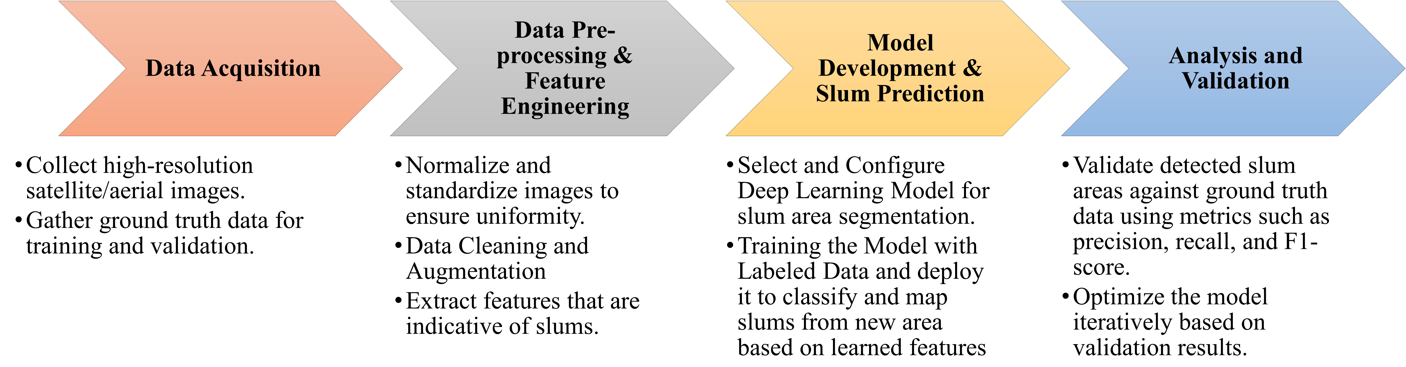
- Web of Science, Scopus, ScienceDirect에 걸친 체계적 문헌 고찰.
- 슬럼, 비공식 정착지, 원격 탐지, 위성 영상, 딥러닝 또는 신경망과 관련된 키워드를 사용한 검색.
- 사전 선정된 영어 본문 연구(2014–2024) 중 방법론 상세가 충분한 문헌의 PRISMA 기반 선별.
- 지역, 데이터셋, 전처리, 모델 구조를 분석하기 위해 40편의 적격 출판물의 추출 및 합성.
- 아키텍처 및 학습 관행의 메타 분석적 합성을 통해 경향 및 공백 식별.
- GIS와의 통합 및 윤리적 고려사항에 대한 논의.
![Figure 1: Geographic distribution of the proportion of urban populations residing in slums by country [ 7 ] . The color gradient indicates the percentage, with darker shades representing higher proportions. The absence of colors denotes the unavailability of data.](https://ar5iv.labs.arxiv.org/html/2406.08031/assets/geographic.png)
실험 결과
연구 질문
- RQ1슬럼 맵핑 딥러닝 연구가 학습 및 테스트를 위해 어떤 지역에서 모델을 훈련하고 평가했는가?
- RQ2슬럼 맵핑을 위한 딥러닝에 어떤 데이터 소스 및 데이터셋이 사용되었는가?
- RQ3이 모델들의 학습 및 테스트 데이터는 전처리, 증강, 클래스 불균형 등 어떤 방식으로 준비되었는가?
- RQ4예측 모델의 구조는 어떻게 되어 있는가(아키텍처, 학습 방식, 전이 학습)?
- RQ5지배적인 도전과 한계는 무엇이며 이를 해결하기 위해 어떤 전략이 제안되었는가?
주요 결과
- 슬럼 맵핑을 위한 점점 더 복잡한 신경망 아키텍처로의 경향이 있다.
- 데이터 전처리 및 모델 학습 기법이 슬럼 식별 정확도를 크게 향상시킨다.
- 전 universally 최적의 모델은 없으며 특정 지리적 맥락에 맞는 적응이 필요하다.
- 데이터 한계와 모델 설명가능성 lack는 이 분야의 주요 도전과제로 남아 있다.
- 메타 분석은 다양한 지역과 데이터 소스를 다루며 DL을 슬럼 맵핑에 적용하는 것이 빠르게 성장하고 있지만 아직 초기 단계임을 시사한다.
- PRISMA 흐름도 및 표 I가 연구 선택 및 저널 분포를 요약한다.
더 나은 연구,지금 바로 시작하세요
논문 읽기부터 검토까지, 연구 시간을 획기적으로 줄여보세요.
카드 등록 없음 · 무료 플랜 제공
이 리뷰는 AI가 만들고, 인간 에디터가 검토했습니다.