
[論文レビュー] Deep Learning for Slum Mapping in Remote Sensing Images: A Meta-analysis and Review
この論文は、リモートセンシングデータからのスラム地区マッピングにおける深層学習アプローチの系統的メタ分析(2014–2024)を実施し、アーキテクチャ、データソース、前処理、課題を要約して今後の研究を導く。
The major Sustainable Development Goals (SDG) 2030, set by the United Nations Development Program (UNDP), include sustainable cities and communities, no poverty, and reduced inequalities. However, millions of people live in slums or informal settlements with poor living conditions in many major cities around the world, especially in less developed countries. To emancipate these settlements and their inhabitants through government intervention, accurate data about slum location and extent is required. While ground survey data is the most reliable, such surveys are costly and time-consuming. An alternative is remotely sensed data obtained from very high-resolution (VHR) imagery. With the advancement of new technology, remote sensing based mapping of slums has emerged as a prominent research area. The parallel rise of Artificial Intelligence, especially Deep Learning has added a new dimension to this field as it allows automated analysis of satellite imagery to identify complex spatial patterns associated with slums. This article offers a detailed review and meta-analysis of research on slum mapping using remote sensing imagery from 2014 to 2024, with a special focus on deep learning approaches. Our analysis reveals a trend towards increasingly complex neural network architectures, with advancements in data preprocessing and model training techniques significantly enhancing slum identification accuracy. We have attempted to identify key methodologies that are effective across diverse geographic contexts. While acknowledging the transformative impact Convolutional Neural Networks (CNNs) in slum detection, our review underscores the absence of a universally optimal model, suggesting the need for context-specific adaptations. We also identify prevailing challenges in this field, such as data limitations and a lack of model explainability and suggest potential strategies for overcoming these.
研究の動機と目的
- SDG指向の都市計画を情報提供するための正確なスラムの位置と範囲データを動機づける。
- 多様な文脈にわたってリモートセンシングでのスラムマッピングに用いられる深層学習手法を統合する。
- データソース、前処理ワークフロー、モデルアーキテクチャを特定し、スラム検出を改善する。
- データ制約、解釈性などの課題を強調し、進展のための戦略を提案する。
提案手法
- Web of Science、Scopus、ScienceDirect の系統的文献調査。
- スラム、非公式居住地、リモートセンシング、衛星画像、深層学習、ニューラルネットワークに関連するキーワードを用いた検索。
- 2014–2024 に焦点を当て、十分な方法論的詳細を有する英語論文をPRISMAに基づいてスクリーニング。
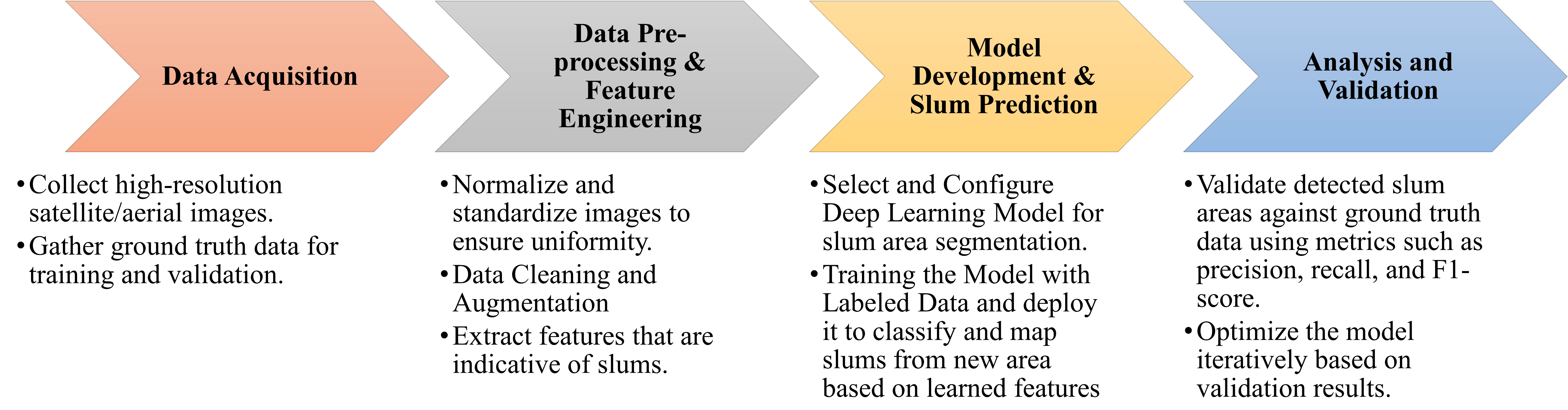
- 地域、データセット、前処理、モデル構造を分析するための40件の適格論文の抽出と統合。
- アーキテクチャとトレーニング慣行のメタ分析的統合を行い、傾向とギャップを特定。
- GISとの統合と倫理的配慮について議論。
![Figure 1: Geographic distribution of the proportion of urban populations residing in slums by country [ 7 ] . The color gradient indicates the percentage, with darker shades representing higher proportions. The absence of colors denotes the unavailability of data.](https://ar5iv.labs.arxiv.org/html/2406.08031/assets/geographic.png)
実験結果
リサーチクエスチョン
- RQ1スラムマッピングの深層学習研究はどの地域でモデルを訓練・テストしたか?
- RQ2スラムマッピングに深層学習で使用されるデータソースとデータセットは何か?
- RQ3これらのモデルのためのトレーニングデータとテストデータはどのように準備されたか(前処理、データ拡張、クラス不均衡など)?
- RQ4予測モデルの構造(アーキテクチャ、トレーニングレジーム、転移学習)はどうか?
- RQ5支配的な課題と限界は何で、解決のためにどのような戦略が提案されているか?
主な発見
- スラムマッピングのためのより複雑なニューラルネットワークアーキテクチャの傾向が見られる。
- データ前処理とモデル訓練技術は、スラム識別の精度を大幅に向上させる。
- 普遍的に最適なモデルは存在せず、特定の地理的文脈に合わせた適応が必要。
- データ制約とモデルの説明性の欠如は、この分野の主要な課題である。
- メタ分析は多様な地域とデータソースを対象としており、DLをスラムマッピングへ適用する進展は迅速である一方、萌芽的であることを示している。
- PRISMAフローダイアグラムと表Iが研究選定とジャーナル分布を要約する。
より良い研究を、今すぐ始めましょう
論文の読解から最終レビューまで、研究時間を劇的に削減しましょう。
クレジットカード登録不要
このレビューはAIが作成し、人間の編集者が確認しました。