
[Paper Review] Deep Learning for Slum Mapping in Remote Sensing Images: A Meta-analysis and Review
This paper conducts a systematic meta-analysis (2014–2024) of deep learning approaches for slum mapping from remote sensing data, summarizing architectures, data sources, preprocessing, and challenges to guide future research.
The major Sustainable Development Goals (SDG) 2030, set by the United Nations Development Program (UNDP), include sustainable cities and communities, no poverty, and reduced inequalities. However, millions of people live in slums or informal settlements with poor living conditions in many major cities around the world, especially in less developed countries. To emancipate these settlements and their inhabitants through government intervention, accurate data about slum location and extent is required. While ground survey data is the most reliable, such surveys are costly and time-consuming. An alternative is remotely sensed data obtained from very high-resolution (VHR) imagery. With the advancement of new technology, remote sensing based mapping of slums has emerged as a prominent research area. The parallel rise of Artificial Intelligence, especially Deep Learning has added a new dimension to this field as it allows automated analysis of satellite imagery to identify complex spatial patterns associated with slums. This article offers a detailed review and meta-analysis of research on slum mapping using remote sensing imagery from 2014 to 2024, with a special focus on deep learning approaches. Our analysis reveals a trend towards increasingly complex neural network architectures, with advancements in data preprocessing and model training techniques significantly enhancing slum identification accuracy. We have attempted to identify key methodologies that are effective across diverse geographic contexts. While acknowledging the transformative impact Convolutional Neural Networks (CNNs) in slum detection, our review underscores the absence of a universally optimal model, suggesting the need for context-specific adaptations. We also identify prevailing challenges in this field, such as data limitations and a lack of model explainability and suggest potential strategies for overcoming these.
Motivation & Objective
- Motivate accurate slum location and extent data to inform SDG-oriented urban planning.
- Synthesize deep learning methods used for slum mapping in remote sensing across diverse contexts.
- Identify data sources, preprocessing workflows, and model architectures that improve slum detection.
- Highlight challenges (data limitations, explainability) and propose strategies for advancement.
Proposed method
- Systematic literature review across Web of Science, Scopus, and ScienceDirect.
- Search using keywords related to slum, informal settlement, remote sensing, satellite imagery, deep learning, or neural networks.
- PRISMA-based screening to select relevant full-text studies in English with sufficient methodological detail (2014–2024).
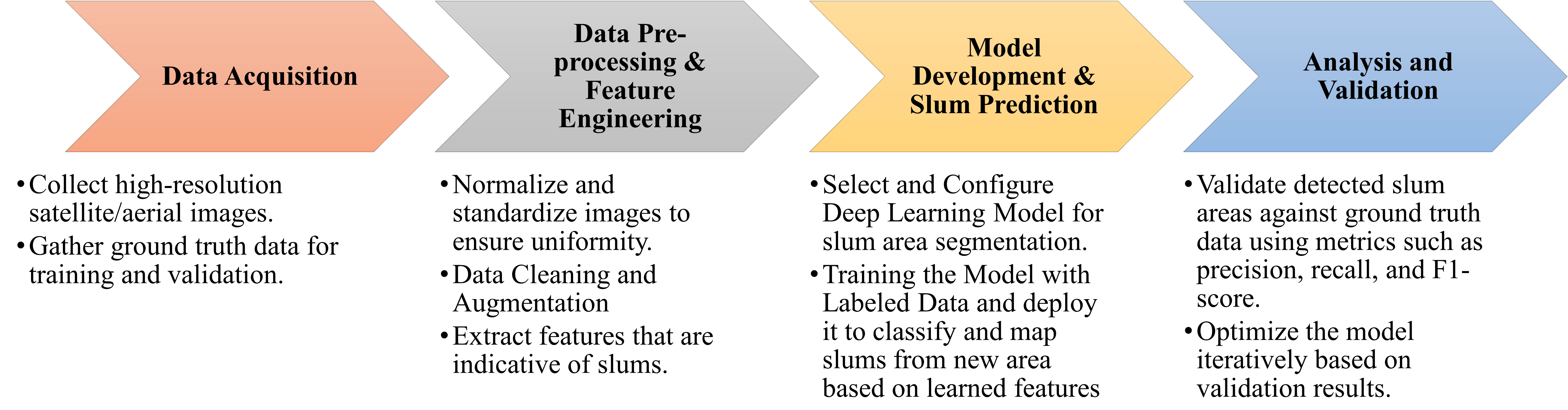
- Extraction and synthesis of 40 eligible publications to analyze regions, datasets, preprocessing, and model structure.
- Meta-analytic synthesis of architectures and training practices to identify trends and gaps.
- Discussion of integration with GIS and ethical considerations.
![Figure 1: Geographic distribution of the proportion of urban populations residing in slums by country [ 7 ] . The color gradient indicates the percentage, with darker shades representing higher proportions. The absence of colors denotes the unavailability of data.](https://ar5iv.labs.arxiv.org/html/2406.08031/assets/geographic.png)
Experimental results
Research questions
- RQ1What regions have the slum-mapping deep learning studies trained and tested their models in?
- RQ2What data sources and datasets are used for slum mapping with deep learning?
- RQ3How are training and testing data prepared (preprocessing, augmentation, class imbalance, etc.) for these models?
- RQ4What is the structure of the predictive models (architectures, training regimes, transfer learning)?
- RQ5What are the prevailing challenges and limitations, and what strategies are proposed to address them?
Key findings
- There is a trend toward increasingly complex neural network architectures for slum mapping.
- Data preprocessing and model training techniques significantly enhance slum identification accuracy.
- There is no universally optimal model; adaptations are needed for specific geographic contexts.
- Data limitations and lack of model explainability remain key challenges in this field.
- The meta-analysis covers diverse regions and data sources, indicating rapid but nascent growth in applying DL to slum mapping.
- A PRISMA flow diagram and Table I summarize the study selection and journal distribution.
Better researchstarts right now
From reading papers to final review, dramatically reduce your research time.
No credit card · Free plan available
This review was created by AI and reviewed by human editors.