
[Paper Review] Mapping Walnut Water Stress with High Resolution Multispectral UAV Imagery and Machine Learning
This study develops a machine learning framework using high-resolution multispectral UAV imagery and weather data to map walnut water stress at the individual tree level. By applying Random Forest regression and classification models, it achieves R² = 0.70 and 85% accuracy in estimating stem water potential and classifying stress levels, demonstrating a scalable, cost-effective alternative to manual measurements for precision irrigation in walnut orchards.
Effective monitoring of walnut water status and stress level across the whole orchard is an essential step towards precision irrigation management of walnuts, a significant crop in California. This study presents a machine learning approach using Random Forest (RF) models to map stem water potential (SWP) by integrating high-resolution multispectral remote sensing imagery from Unmanned Aerial Vehicle (UAV) flights with weather data. From 2017 to 2018, five flights of an UAV equipped with a seven-band multispectral camera were conducted over a commercial walnut orchard, paired with concurrent ground measurements of sampled walnut plants. The RF regression model, utilizing vegetation indices derived from orthomosaiced UAV imagery and weather data, effectively estimated ground-measured SWPs, achieving an $R^2$ of 0.63 and a mean absolute error (MAE) of 0.80 bars. The integration of weather data was particularly crucial for consolidating data across various flight dates. Significant variables for SWP estimation included wind speed and vegetation indices such as NDVI, NDRE, and PSRI.A reduced RF model excluding red-edge indices of NDRE and PSRI, demonstrated slightly reduced accuracy ($R^2$ = 0.54). Additionally, the RF classification model predicted water stress levels in walnut trees with 85% accuracy, surpassing the 80% accuracy of the reduced classification model. The results affirm the efficacy of UAV-based multispectral imaging combined with machine learning, incorporating thermal data, NDVI, red-edge indices, and weather data, in walnut water stress estimation and assessment. This methodology offers a scalable, cost-effective tool for data-driven precision irrigation management at an individual plant level in walnut orchards.
Motivation & Objective
- To develop a scalable, non-invasive method for monitoring walnut water stress across entire orchards to support precision irrigation.
- To overcome the limitations of labor-intensive, point-based stem water potential (SWP) measurements by leveraging high-resolution UAV remote sensing.
- To integrate multispectral imagery, thermal data, and weather variables (wind, temperature, VPD) into machine learning models for improved SWP estimation.
- To evaluate the relative importance of vegetation indices (NDVI, NDRE, PSRI) and weather factors in predicting walnut water stress.
- To classify water stress into three severity levels (low, moderate, severe) with high accuracy for actionable irrigation planning.
Proposed method
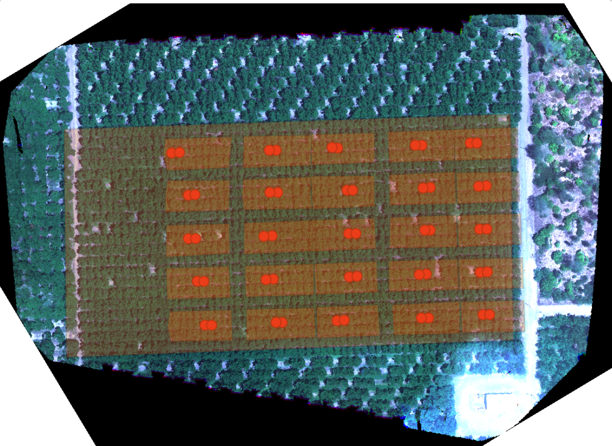
- Conducted five UAV flights over a commercial walnut orchard using a seven-band multispectral camera, capturing high-resolution orthomosaicked imagery.
- Collected concurrent ground-truth SWP measurements from 200 walnut plants using pressure chambers to calibrate models.
- Calculated key vegetation indices including NDVI, NDRE, PSRI, and used thermal band data from the multispectral sensor.
- Integrated local weather data (wind speed, air temperature, vapor pressure deficit) from a nearby station to account for temporal variability.
- Trained Random Forest regression and classification models using the combined dataset, with feature importance analysis to identify key predictors.
- Applied the Normalized Excess Green Index (NExG) to filter out shadow effects in thermal and multispectral imagery.
Experimental results
Research questions
- RQ1Can high-resolution multispectral UAV imagery combined with weather data enable accurate estimation of walnut stem water potential (SWP) at scale?
- RQ2Which vegetation indices (NDVI, NDRE, PSRI, etc.) and weather variables (wind, VPD, temperature) are most predictive of walnut water stress?
- RQ3How does the inclusion of red-edge indices (NDRE, PSRI) improve SWP estimation accuracy compared to models using only standard indices?
- RQ4Can a machine learning classification model reliably categorize walnut water stress into three distinct levels (low, moderate, severe)?
- RQ5To what extent does integrating weather data enhance model performance across multiple flight dates with varying conditions?
Key findings
- The Random Forest regression model achieved an R² of 0.70 and a mean absolute error (MAE) of 0.80 bars in estimating ground-truth stem water potential (SWP).
- The inclusion of weather data—particularly wind speed—significantly improved model consistency across different flight dates, highlighting its importance in temporal data consolidation.
- NDVI was the most significant vegetation index for SWP estimation, followed by thermal band, NDRE, and PSRI in descending order of importance.
- Excluding red-edge indices (NDRE, PSRI) reduced model accuracy, with R² dropping to 0.63, confirming their value in capturing early water stress.
- The Random Forest classification model correctly predicted water stress severity levels with 85% accuracy, outperforming a reduced model (80% accuracy).
- The study confirms that integrating multispectral, thermal, and weather data via machine learning enables precise, scalable, and cost-effective individual-plant-level water stress mapping in walnut orchards.
Better researchstarts right now
From reading papers to final review, dramatically reduce your research time.
No credit card · Free plan available
This review was created by AI and reviewed by human editors.